 By
Sam Lepore
By
Sam Lepore
"I always wanted to see Montana."
- The Captain of the Russian submarine Red October, played by Sam Neil.
First, some belated follow up from my previous musings. Despite some inventive suggestions about the rock piles I saw in Oregon, no one provided as precise an answer as Michael Hunt (repeated here for the benefit of those not on the LDR list). Strange, though, that he commented they are also in Idaho but my immediate observation was they weren't ...
"They are called 'stone bucks'
or 'stone buck' for the singular.
They are usually used in
rocky ground where it can be difficult
to set a fence post.
Some use them as the corner marker for
a section (1sq. mi.).
They also come in square, rectangular
and triangular form.
You will also find them
in Idaho and other states w/more than
their fair share of rocks."
And my call for long distance "last gas" brought this from Bob Hole.
"I saw a next gas sign east of Tonopah, NV, saying next gas 91 miles."
Now picking up where I left
off in Kooskia - I have always been driven by curiosity, and I am still
a most curious fellow (no matter how you interpret that :). If ignorance
is bliss, why aren't I happy? I seem to question everything that does not
need questioning. Kooskia, for example. I asked at the gas station, what
does it mean. "No idea", said the woman. "Been here a dozen years and no
one ever asked that. I do know it is a Nez (Perce) word, though, and it
is pronounced koo-SKY-ah, not koosk-ee-uh."
This morning at breakfast
in the Rivers Cafe (hint hint), I asked the waitress/manager/owner. She
gave me gave me a look like I had just asked her why does she breathe air.
She said "I've been here 40 years and I have never thought to ask that
question." Ignorance is not bliss when you realize you were ignorant of
your ignorance.
The man in the first booth
never looked up and never stopped shoveling eggs. "Koo-shky-yeh means 'where
the rivers meet'."
"No", says a woman at the
counter. "It means 'two waters together'!"
By which time I had paid
my bill and was leaving. Two minutes ago in the Rivers Cafe (hint) the
subject had never been discussed and now there was an etymological argument
of the finer points of Nez. By the way, Koo-whatever is at the confluence
of the (South) Clearwater and the (Middle) Clearwater. Clear?
Motorcyclists are often chased
by dogs. Some dogs even do it for fun. As I started up Route 12, I was
fun chased by a horse. Traffic was slow, about 30. We rounded a bend that
ran close to a fence. The horse probably saw my headlight, then he took
a couple steps toward the fence and started running along side me. He wasn't
spooked, and he didn't turn away - he kept up for about 100 yards. Wow,
talk about iron horse. This was a long distance STrider!
It was a good day for a
ride (what day isn't?) The smoky mists were steaming out of the trees and
cascading over the cold air above the rushing water. Combined with the
spray from the many rapids, it made a fine layer of natures whipped cream
swirled over the open spaces. In some places the mist was thick enough
to drip. In San Francisco will call this "fog fall", but even though it
was cold enough for me to plug in and turn on the electric jacket, it wasn't
enough to make the road slick.
And there, around the first
bend north of Lovell was THE SIGN. The sign most often photographed by
motorcycle travelers. Yellow sign. Big letters. "Winding Road next 77 miles".
Can't help but smile when you know it is for real. The pavement is clean
and smooth the whole way. There are plenty of passing zones. There are
few driveways or other distractions. What a nice way to spend an hour ...
err, an hour and a quarter ... err, an hour and thirty five minutes if
you believe in the speed limit (50).
OK, next "rock pile" question! To make a writing note, I stopped in a paved pullout area just past THE SIGN. Painted on the ground in those official huge stencil letters only DOT uses was the admonition DONT ... BE ... A ... GUBERIF. Man, I looked at that like it was a 7th grade essay test. Guberif. Yeah, that's how it was spelled. "You might be a guberif ...?" OK, Mr. Idaho, what the $#@% is a guberif? (I am not making this up - go look for yourself!)
Two hours, or ten days? US12
follows the Locsha River along what we now call the Lewis and Clark Trail.
Almost 200 years ago they came this very way, and I am relieved to say
that the other side of the river still looks like it could have then. Rugged.
Original. Too rough for foot traffic. I thought about them floating in
their boats as I floated along the pavement. On a good day traveling upstream
they could make 10 miles. The 100 miles to the top of the pass took them
10 days. It took me less than two hours.
How fast is too fast? Not
too fast to travel, but too fast to see what you are passing. Our mode
of transportation today would stun Lewis and Clark. But we travel at just
about the limit for still being able to "see" where we are. Will travelers
200 years from now think the same as they step out of the beam transporter?
A bullet train gets there fast, but what do you see of the flowers along
the way? I could go faster ... but I choose not to. I hope we never get
automatic vehicle controls "for better service" such that we can't go as
'fast' as we want.
My day for playful animal chases. A no-horn sheep munching at the edge of the road was startled by the bike bursting out of the forest curve. (It would have been a big-horn, but it was a female.) It leapt up the rocky incline and started running parallel to the road. I slowed to match it's speed. Being up on the ledge, it could not jump in my way, and I wasn't close enough to spook it. From my thoughts of "speed" above, can you imagine running at 25 mph over rocks that appear to have no flat surfaces. The sheep was effortless, graceful, and amazing.
The top of Lolo Pass is the
Montana border. When did Montana become a gambling everywhere state? Later
I would see "casinos" in supermarkets, gas stations, and even a pharmacy
(risk your aspirin money and get a bigger headache?), but some of them
must have been in a rush when the law changed. The first sign past the
border was for Lucky Diamond Casino - NEXT RIHGT.
Sigh.
All my motorcycle friends
know of the other recent legal change in Montana ... there is a speed limit
now. For a while, there was no set limit because of a challenge to the
former law which was: "Reasonable and Prudent". The challenge was not successful,
but the R&P law was ruled unconstitutionally vague. Now the limit is
70. 70 on 4-lanes, 70 on 2-lanes. 70 in driveways ... but rest assured
R&P is still the practice anywhere off the Interstate. I would be rolling
along at a Reasonable 70 on some backroad and a pickup would Prudently
pass me, again and again.
Passing through Helena reminded
me of my last visit there 20 years ago. While we were gassing up the van,
a drunk spied the Massachusetts plates, then wobbled over to Rebecca and
said "Shay shumpin to me in Massashushits". Not being one to take advantage,
she tried to explain we all spoke English ... but I don't think he understood
the language. I always thought the best answer would have been to look
him squarely in the unfocused crossed eyes and say "cranberry bog". Forget
official state symbols ... say something to me in - hmmm, California: Duuude.
My tires have not tasted
Interstate pavement since California, duuude, but finally there is no other
choice. So it's off again with the truck fumes and the fuming families
in minivans as I race off to meet Duner in Bozeman.
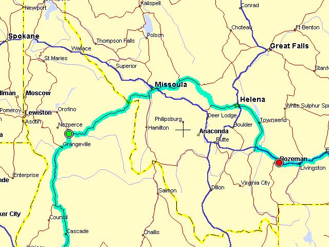
FuelPlus 369 miles, 5:48 hours, 62 mph
Koo-whatever US12 MT200 MT141 US12 US287 Indian205 I90 Bozeman
Sam Lepore, San Francisco
________________
Wanderlust Rider