 By
Sam
Lepore
Subject: WanderNorth 7 - Hyder, Alaska
Date: Fri, 08 Jun 2001 22:18:41 -0700
To the ends of the earth. Well, not exactly, but it is my last state.
Getting there is good. Getting back is better.
At last I got to see some wild life. It started with
a gaggle of Canadian honkers rummaging beside the road. Until now the closest
I'd seen to a Canadian honker was an angry Vancouver bus driver blowing
his horn. Then came a few deer and finally a black bear. When I saw the
deer I whistled a deer whistle inside my helmet but it had no effect. When
I saw the bear I whistled again, and the bear looked up. That's about as
scientific as the published results for deer whistles. Still no moose,
so I didn't try my moose whistle but then after the story of a rider who
hit a moose on his way to witness Ron's finish three years ago, maybe I
don't need to see one up close after all.
Stopped for gas in Kitwanga, I grabbed a snack of
fresh hot Indian fry bread. What is it about fry bread - do the Indians
serve it because the tourists expect it or is it really common to all native
cultures? Whatever, it was good, fluffy, and full of calories. For the
second time in two days I was asked which ferry I had come on. Despite
the increasing number of motorcycles on the road, most locals can't fathom
anyone actually riding this far. Trust me ... when you see a bike "out
there" it is more likely it came all the way than rode a train or a boat.
The other day I mentioned the 'good news' of my
GPS having Canadian roads. The other news is ... well, remember the saying
that close only counts in horseshoes and hand grenades? The base map is
'close' for nuclear weapons. Follow highway 97 on the GPS and you'll go
about 20 kilometers down a gravel road rather than through the town of
Williams Lake. Follow highway 16 on it and you'll be on the wrong side
of the Skeena River ... with no bridge to get there. I usually write to
Garmin after a long trip to tell them the minor discrepancies I found in
the base map. The title for this report would have to be: Canada moved.
 After turning north for the last time at Kitwanga, there is suddenly an
alpine feel to the day, even at the lowly altitude of 300 meters. First,
it is only 5 degrees C at noon, and the trees are mostly spruce and widely
spaced aspen. Even the ground cover has diminished to low growth thin grass.
With the increasing mountains and snow covered peaks, I'd swear I was nearing
the tree line instead of the ocean. The mountains are quite rugged in the
last westerly stretch to Stewart/Hyder. There are several places where
blue ice glaciers have strained and slumped on the slopes, showing stratiated
fissures.
 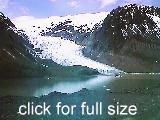 The
road passes the active Bear Glacier, which flows down around a curved pass
into a lake and calves chunks of brilliant blue ice the size of busses.
 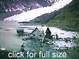 At
the end of the lake is an old, partially submerged house that looked like
someone forgot to consider the rise of the melting glacier years ago when
it was built. It was weathered, but, strangely, a group of men were working
on the outside. Later in Hyder I found that the entire house and supporting
structures are a new set being constructed for a Robin Williams movie,
called Insomnia, due to start filming next Thursday. (And if you didn't
know, Hyder is where the scenes for Leaving Normal were filmed.)
This section of BC37 is the only place I've seen
any significant RCMP presence. There were three trolling troopers within
a 20 kilometer stretch. I wonder - if two patrol cars approach each other
with radar on, does each cancel out the other? Or do both units go wild?
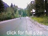 At last! Around the curve, there is the sign: Entering Hyder Alaska. The
pavement ends. The entire "town" is one block long. There is a white horse
standing in the middle of the road, casually observing, as though I am
obviously the unusual traffic. No one is in much of a rush here, and the
horse knows it.
There are already a few bikes at the Inn. Ron is
among them. Chatting with him later, I learn he came by way of the Top
of the World highway, the long way around Alaska, through Dawson, 'down'
to Tok and Fairbanks. He's been on the road since mid May. Talking about
routes, he said in deadpan seriousness, "Next time I'd like to plan a longer
route ..."
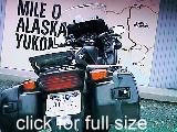 As the sun is just beginning to set at 10 pm, there
are about 20 bikes in the lot. The locals have already given a name to
the group that shows up every year on the weekend closest to June 14 (even
when Ron didn't come one year!): the Hyder Seekers.
209 miles
Smithers BC16 BC37 BC37A Hyder
_________________________
Sam Lepore, San Francisco
Previous Index Next
© 1997, 1999, 2000,
2001
 After turning north for the last time at Kitwanga, there is suddenly an
alpine feel to the day, even at the lowly altitude of 300 meters. First,
it is only 5 degrees C at noon, and the trees are mostly spruce and widely
spaced aspen. Even the ground cover has diminished to low growth thin grass.
With the increasing mountains and snow covered peaks, I'd swear I was nearing
the tree line instead of the ocean. The mountains are quite rugged in the
last westerly stretch to Stewart/Hyder. There are several places where
blue ice glaciers have strained and slumped on the slopes, showing stratiated
fissures.
  The
road passes the active Bear Glacier, which flows down around a curved pass
into a lake and calves chunks of brilliant blue ice the size of busses.
  At
the end of the lake is an old, partially submerged house that looked like
someone forgot to consider the rise of the melting glacier years ago when
it was built. It was weathered, but, strangely, a group of men were working
on the outside. Later in Hyder I found that the entire house and supporting
structures are a new set being constructed for a Robin Williams movie,
called Insomnia, due to start filming next Thursday. (And if you didn't
know, Hyder is where the scenes for Leaving Normal were filmed.)
 By
Sam
Lepore


