 By
Sam Lepore
By
Sam Lepore
Ah, jeez, what kind of penance am I going to have to do after this trip? Another brilliant sunny morning when the forecast called for Noah to book the entire Princess Cruise Lines fleet. Oh, well, you expect it, so off I go.
First act is a donut shop. Scene1 - Traveler enters left.
No one at counter. Woman in floured apron comes from back.
Woman: "Mornin'. Whatcha
want."
Traveler: "I'd like a coffee
and a couple of donuts."
W: "We don't have any donuts.
Got some eclairs, fritters, and pastries."
T: "A donut shop without
donuts?"
W: "They don't sell, so
we stopped making them."
Traveler now sees a tray of donut holes and decides to have fun.
T: "Where are the donuts
you took those holes from?"
Woman, perplexed, looks at donut ... err, donutless case. Turns and
shouts.
W: "Hey Martha, we got any
donut dough left?"
Mumbled response comes from in back. Woman realizes what's up.
W: "Sorry, we only make
holes. Have a pastry and I'll put a hole in it."
A current business homily says - when you find yourself in a hole, stop digging.
Barely beyond the Silver
City limit, the Continental Divide passes between Bear Mountain and Burro
Mountain. When I cross the divide, I always feel a rush, like I am in the
'real' west, my west, the west I know well (although there is much yet
to see). Knowing now that the rivers I see will flow with me to the Pacific
gives me a feeling of being pointed in the right direction. There is no
significance to it, of course, but there is no significance to any of this
trip ... a trip really takes place only in one's mind.
" . . . once you have traveled,
the voyage never ends but is played out over and over again in the quietest
chambers . . . the mind can never break off from the journey."
- Pat Conroy (b. 1945) American
writer
Proving again that civilian
handheld GPS devices are not quite accurate enough to deliver wartime arsenal,
I went off the end of the world, then went around the edge of the world
later. I found two more base map errors. One has NM78 ending at Mule Creek.
(If you stop there you will miss a wonderful descent through the pine forests
into the copper canyons of Arizona.) The other is in the copper canyons,
where the track I followed (i.e. staying on the pavement) went west of
the mapped road by about two miles. You see, there is this little obstacle,
known as the mile deep Phelps-Dodge open pit copper mine. An awesome sight,
and a monument to the hubris of man. Not only did they literally move the
mountain, but they rerouted the road over to the undesirable digs. I have
seen what I remember is or was the world's largest open pit mine in Bisbee,
but this is even more impressive because you see an entire mountain sliced
in half from top to bottom.
The trucks used to port
the ore are the incredible 60-cubic-yard(?) haulers with wheels 20 feet
high. Traffic is stopped at the highway when they approach (lotsa momentum
there!), and to keep others out of their roadway, there are "fences" of
several rows of tractor truck tires laid out on the ground. Even a off-road
4-wheel drive would have trouble hopping them. The haulers cruise over
the tire fences like you would over a garden hose. Just crush and roll.
(Rock n roll? :)
A disturbing trend is appearing.
New Mexico on that wonderful Geronimo Trail, and Arizona on the Coronado
Trail (US191) have marked the speed limit at absurdly low numbers: 35 or
even 25 mph. These speeds may be appropriate for RVs (maybe), but placing
an artificially low limit only conditions drivers to ignore them. It is
not a revenue generation issue ... some of these roads are so remote I
doubt they are patrolled at all. Again I call for vehicle variable limits.
With no traffic in sight I felt cautious and even conservative in taking
some of these curves at 50. 25? Get real! That's hardly different from
the earliest days of automobile travel when a man with a lantern was required
to precede the vehicle. On foot.
Incidentally, speaking of
maps, conservatives, and trends, it is true that the conservatives have
triumphed in Arizona. The mark of the devil has been removed from the highway
system. What was marked as US666 is no more although it still shows on
some maps. Instead, other route numbers share the same road, mostly US191.
We'll soon see if New Mexico shares the superstition.
Tracking the continuing "storms
deluging the southwest", I expected to encounter afternoon thunderstorms.
I did race two rain clouds across the Little Colorado Valley, but they
chose not to follow, preferring the high country. During this stretch I
noticed a different genus of tar snake on the road. Instead of the dreaded
black snake, these were a mixture of brown and black, with the newer ones
appearing to be all brown. Is this the new formula we have heard some states
are trying, to make them less gooey and less dangerous for motorcycles?
The road surface wasn't hot enough for me to feel the black snakes slip,
so I didn't notice any difference with the browns.
With the storms close behind
me, there was a lot of wind turbulence between hot fields, cool dips, and
wind ridges. I got hit with a sudden wind shear on the crest of one rise,
but it was just like a slap from each side. Then ahead I saw a new sight
in my motorcycling experience ... at the top of the next rise a tumbleweed
was crossing from left to right, then it was crossing from right to left,
and back and forth. As I approached, I suddenly realized it was not moving
laterally, it was rapidly going in a circle. This was a mean mother of
a cyclone sitting on the ridge, and that was a tumbleweed warning. I quickly
lowered the windscreen for a minimum flat face, tucked myself in as tight
as I could, and braced. Even prepared, that wind hit like a hammer. The
roar inside the helmet hurt even with earplugs, and I could feel a pressure
pop as I blew through the center. It was all of 40 or 50 feet wide ...
but it was like a small clear-air tornado. Sure glad I saw that tumbleweed
(and paid attention!).
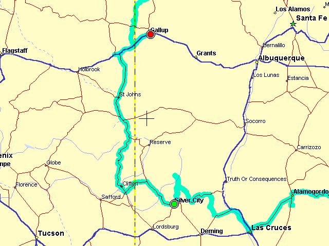
FuelPlus 348 miles, 6:37 hours engine, 53 mph average
Silver City US180 NM78/AZ78 US191(US666) I40 Gallup
Sam Lepore, San Francisco
________________
Wanderlust Rider